The Kansas City metro is in a flood watch as severe weather and heavy rain are likely to continue throughout the weekend.
An additional 1-3 inches of rain are expected through Sunday. This may lead to flash floods after 2-4 inches of rainfall in some areas Friday, according to the National Weather Service in Kansas City.
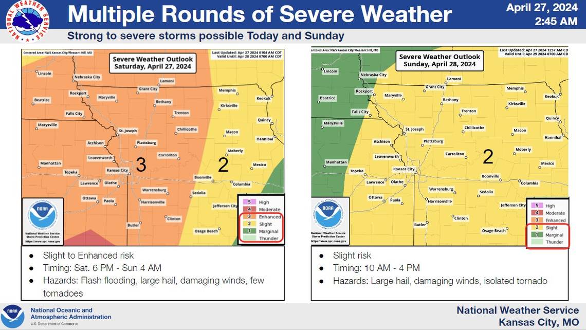
The Kansas City area remains in an enhanced risk for severe weather Saturday, after supercells made their way through parts of eastern Nebraska, west and central Iowa, eastern Kansas and northwest Missouri Friday.
Areas north and south of the Kansas City metro saw tornadoes Friday evening. One tornado was reported by the fire department in Rich Hill, Missouri, where toppled trees blocked part of Highway 52.
Another tornado was reported in Holt County southwest of Skidmore, Missouri, but no damage was reported in its area.
Stronger tornadoes caused severe damage in Nebraska and Iowa Friday. Near Omaha, about 185 miles north of Kansas City, buildings collapsed and homes were leveled in the storm, the Associated Press reported.
On Saturday, severe weather is most likely after 4 p.m. around the Kansas City metro. Flash flooding, large hail around 2 inches in diameter, damaging winds and tornadoes are all possible, according to the weather service.
The greatest threat for tornadoes, though, is along Interstate 29 north of the metropolitan area in northwest Missouri, the NWS said Friday.
From 6 p.m. Saturday through 4 a.m. Sunday, the NWS Storm Prediction Center puts the metro in an enhanced risk for severe weather. The weekend storms could bring another three to four inches of rain, with some areas seeing five to six inches.
The flood watch is in effect for areas south of Highway 36 through Sunday afternoon.
The Star’s Robert Cronkleton contributed to this report.
