A video sharing old earthquake images in Japan has circulated online with a false claim they were taken after a 6.3-magnitude jolt hit the country on April 17. At least eight people were reported injured in the latest quake. Japan experiences around 1,500 earthquakes every year. The vast majority are mild, and even larger quakes usually cause little damage.
“A 6.2-magnitude earthquake hit Shikoku Island, Japan,” read the simplified Chinese text overlaid on a photo compilation published by state-backed broadcaster Russia Today on the video-sharing platform Bilibili on April 18, 2024.
The video included three photos of collapsed buildings and a stock photo of the Japanese flag.
Eight people were reported injured after a 6.3-magnitude earthquake struck off southwestern Japan on April 17, but there was no major damage or tsunami.
The quake’s epicentre was located between the islands of Kyushu and Shikoku, the US Geological Survey said.
The video — viewed more than ten thousand times — was also shared on the Chinese social media platform Weibo.
However, the photos were taken after other earthquakes that previously hit Japan.
Old quake images
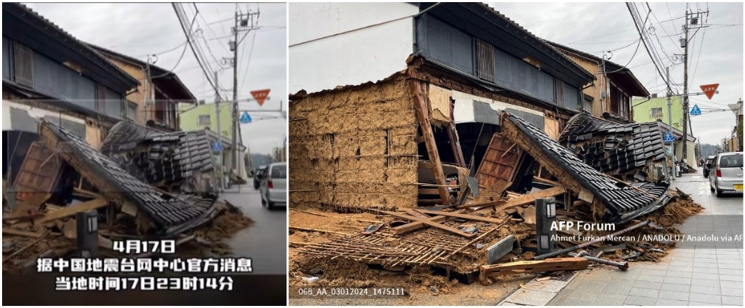
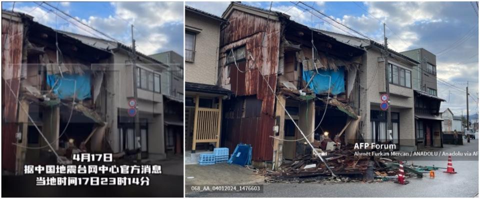
Reverse image searches on Google and TinEye found two of the photos were published by the Turkish news agency Anadolu here and here (archived links here and here).
Both photos — credited to the agency’s photographer Ahmet Furkan Mercan — showed collapsed buildings in Nanao city in Japan’s Ishikawa Prefecture, their captions stated.
One was taken on January 3, 2024, while the other was shot one day after, according to the captions.
Corresponding photos were published by Anadolu here on its website and credited to Mercan (archived link here).
Nanao was one of the cities hit by a powerful earthquake that flattened parts of central Japan on January 1, 2024, and left at least 202 dead.
Below are screenshot comparisons of the images shared in the false video (left) and photos published by Anadolu Agency (right):


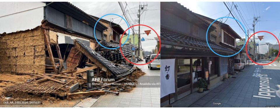
AFP geolocated the second photo to Ipponsugi Street in Nanao. The location can be seen on Google Street View imagery (archived link here).
Below is a screenshot comparison of Anadolu Agency’s photo (left) and the corresponding scene seen on Google Maps’ street view (right):
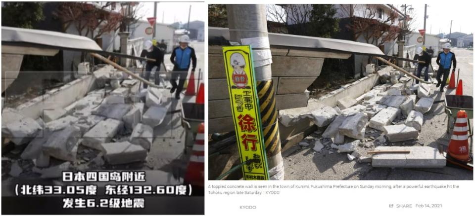
Further reverse image searches found the other photo in the false posts was originally published by the Japanese news agency Kyodo News on February 14, 2021 (archived link here).
It was archived on the website of The Japan Times (archived link here).
It was captioned: “A toppled concrete wall is seen in the town of Kunimi, Fukushima Prefecture on Sunday morning, after a powerful earthquake hit the Tohoku region late Saturday.”
Below is a screenshot comparison of the image shared in the false video (left) and the photo published by Kyodo News (right):
A 7.3-magnitude earthquake that struck off Japan’s Fukushima injured dozens of people, authorities said on February 14, 2021, nearly 10 years after the eastern region was hit by a huge quake that sparked a tsunami and nuclear meltdown.
