Severe spring storms will bring heavy rain and thunder to the Plains and into the Mississippi Valley this weekend — including possible powerful tornadoes, large hail and flooding.
On Friday, 21 million people are at risk for severe storms stretching from northern Iowa to northeast Texas with the main threats including hail up to 4 inches in diameter and a couple of possible strong tornadoes in Kansas City, Missouri, and Omaha, Nebraska.
Tornadoes were reported but unconfirmed in Texas and Nebraska on Friday as the National Weather Service issued a rare “tornado emergency” statement for the area of Blair, Nebraska, a small city about 26 miles north of Omaha.

The emergency also applied to the city of Missouri Valley, Iowa, and nearby parts of Iowa along the Nebraska border. The service describes tornado emergency statements as “exceedingly rare” and says they’re reserved for tornadoes confirmed by reliable sources or manifested via radar data and imagery.
The area covered by the statement faces “a severe threat to human life and catastrophic damage from an imminent or ongoing tornado,” the service said on its online glossary.
The National Weather Service office in Valley, Nebraska, was unable to confirm reports of multiple tornadoes that appeared to touch down north of Omaha as it focused on handling a wave of incoming reports. Multiple social media videos verified by NBC News appeared to show tornadoes in the air and near or on the ground in or near Lincoln, Waverly, and Elba.
Nearly 16 million people are also under tornado watches that extended from central Texas to the top of Nebraska. Tornado warnings, which alert residents to imminent danger and urge them to take cover, were also in effect for parts of eastern Kansas and eastern Nebraska as a line of thunderstorms batter the region.
Police and fire officials in Omaha said two people sustained minor injuries when a tornado touched down in the northwest area of the city.
“It appears that many houses are flattened and many houses also have significant damage,” Omaha Fire Department Chief Kathy Bossman said at an early evening news conference.
Crews would starting searching the area for any potential injured residents tonight, she said. However, the area has homes under construction, Omaha Police Chief Todd Schmaderer said, and may have been empty.
The city is experiencing power outages, gas leaks, and utility poles and tree limbs down in roadways, the fire chief said. More than 8,000 utility customers were without power in Nebraska, according to utility tracker PowerOutage.us.
Schmaderer credited early warnings from the National Weather Service and others for the low number of injured people so far. “Warning systems were highly effective,” he said.
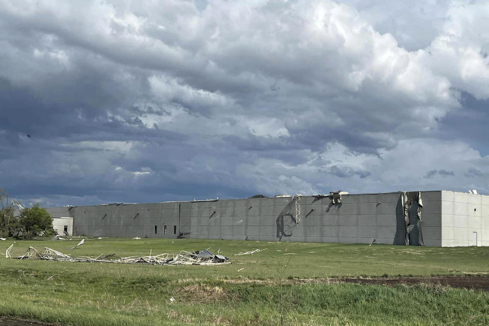
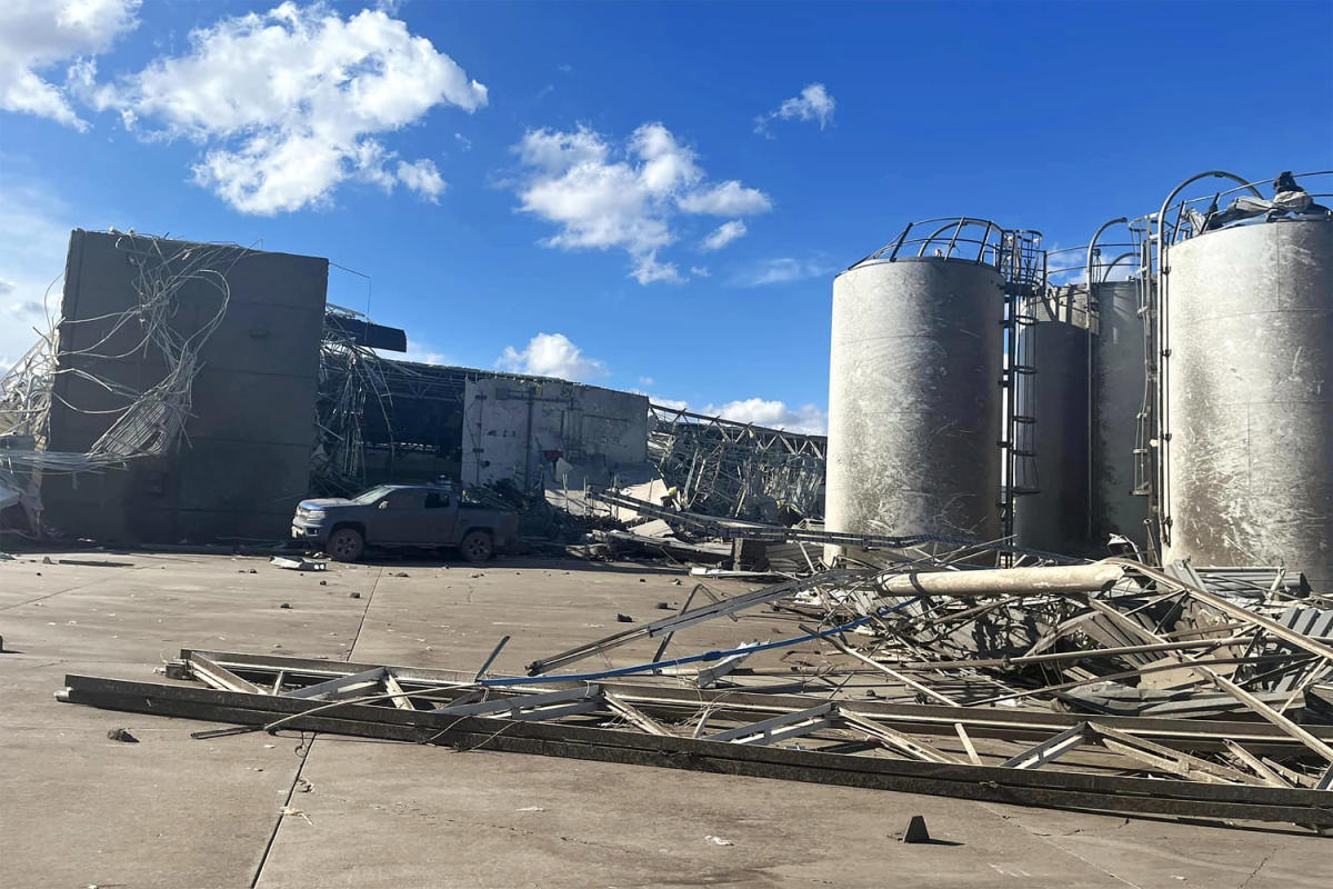
In the area of Lincoln, a 115,00-square-foot facility that produces injection-molded parts used in manufacturing, was flattened by a reported tornado, the Lancaster County Sheriff’s Office said in statements Friday afternoon.
Three people who were at the Garner Industries facility had non-life-threatening injuries, the office said. Nearly 70 others, some initially trapped, were able to exit the facility unharmed, the sheriff’s office said.
The company’s listing on Google says it’s “temporarily closed.” A representative did not immediately respond to a request for comment.


The public school district in Lincoln warned parents planning to pick up their children Friday afternoon that students would be ordered to shelter on campus and unavailable temporarily if the area comes under a tornado warning.
Omaha’s Eppley Airfield said would-be travelers were being moved to storm shelters as the storm caused flight delays.
Homes were damaged and two people suffered minor injuries when a tornado appeared to strike near Abbott, Texas, on Friday, the city’s volunteer fire department chief, Doreen Strickland, said.
The injuries occurred when a semi-truck was blown off Interstate 35, Strickland said.
“The tornado did in fact lay it over on its side, and we’re waiting for equipment to get it back on its wheels,” the chief said.
In Oklahoma, Altus Air Force Base prepared overnight by moving aircraft from the 97th Air Mobility Wing to the Sacramento McClellan Airport in McClellan Park, California, according to a statement.
The most intense storms are expected midafternoon to early evening, and some storms may continue overnight, affecting major cities of Tulsa, Oklahoma; Kansas City, Missouri; Omaha; and Des Moines, Iowa.
The National Weather Service’s Storm Prediction Center had already issued an enhanced risk warning of severe thunderstorms for portions of eastern Nebraska, northeastern Kansas, northwestern Missouri and southwestern Iowa on Friday.
Friday night into Saturday, the system will move farther into the Plains, and heavy snow will develop in the Rockies.
Saturday is forecast to be the most volatile day of the outbreak, with 33 million people at risk from the storms across a large area from southern Texas to northern Michigan.
The main threats Saturday again include very large hail and numerous tornadoes, some of which could be strong and travel long distances — from Ames, Iowa, down to Wichita Falls, Texas.
Come Sunday, relentless storms continue over the Plains, and 20 million people from St. Louis to Dallas could see hazardous storms, though less severe than Saturday’s weather.
There’s an increased risk for flash flooding especially across eastern Oklahoma, where downpours could produce over 6 inches of rainfall through Sunday.
This article was originally published on NBCNews.com
